
This jagged red track on the topo represents about 3 of 5 days recently spent in the Alpine regions of the Weminuche Wilderness of the San Juan Mountains just northeast of Durango. Without a question this was one of the most beautiful (and adventurous) trips I’ve made in a number of years. Putting my ultralight gear to the test was just one of the features of this high country trek of about 53 miles with approximately 16,200′ of elevation gain and a corresponding 18,100′ of descent.
 It’s a wonder that we don’t have to go to far-off regions of the world for an alpine experience, because we have such an amazing 488,210 acres of true wilderness so close to home. The San Juan National Forest, of which the Weminuche is a quarter, is almost 3,000 square miles. Before this trip, I had only “dabbled” in this expansive wonderland, with most trips very near to Trailheads and access roads. Once we got a couple miles in on the Cave Basin trail north of Vallecito Reservoir, we left the beaten trail and rarely trod on designated trails again until we exited the high country at Chicago Basin on the 6-mile downhill route to catch the Silverton Narrow Gauge train at it’s wilderness stop at Needleton. It’s not unusual to have afternoon thunderstorms come thru the San Juans, but we hit the jackpot of adverse weather the first night, when we had hard hail, followed by wet snow, and then another round of hail for a couple of hours.
 Holed up in each of our tents we were dry and warm but the “trim” of the tent shape suffered when loaded down with snow and ice.
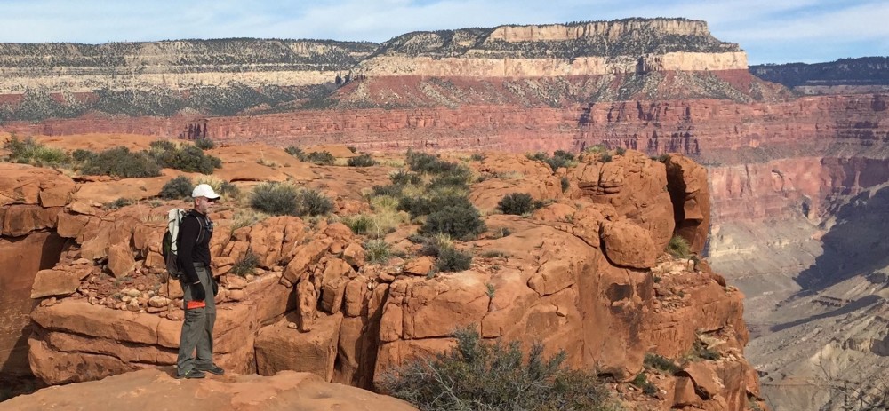
 I’ve signed up to be a Wilderness Information Specialist as a volunteer for the National Forest Service and lucked out to have my indoctrination with Will Rietveld a long time resident of Durango and intimate of San Juans. He prefers to hike off-trail, above tree line, and no longer requires a map. So we spent most of those 5 days high up in the alpine regions of the San Juans, only venturing down into the thinned tree line long enough to contour or traverse up to another pass and on to the next drainage.
We had much in common, most notably an interest in ultralight backpacking gear, as he’s been an ultralight gear editor and writer/reviewer for some online and print publications for over 10 years. Our gear was very similar and/or he knew all about my choices, their weights and usefulness. Needless to say I took copious notes on how to tweak my gear and skills.

 The first four days we only saw three hiking parties and that was when we dropped down to drainages that had established trails. Wearing a Forest Service shirt seems to make folks friendlier and it was fun to “chat them up.” We didn’t see many live elk, however there were numerous mule deer, ptarmigan,and mountain goats, plus the ubiquitous pica and marmots. We were too high to encounter any bear as the foraging above tree line is non-existant.
 The high point, both literally and figuratively, was climb up the east side of the pass between Sunlight and Windom peaks at first light the last morning. Our morning snack at 6:45 am was in the notch at 13,700′ between two of the most popular 14’ers in the Weminuche.
 Oh, Will did find an arrowhead about 50′ from one of our tent sites. Which, according to the rules of the National Forest, remains right where he found it. Here’s hoping that I can remember his shortcuts and routes across that spectacular country.


