Deso-Grey Canyon

Here are some photos of my recent Deso-Grey Canyon trip.  A really troubled turkey spent a day with us.

Another photo of the really deep canyon.

(click here to expand)

Good friends at the BBQ, Mike and John.

What happens when you forget your glasses in your tent.


Trails

We kept at the trails until we’d hiked everything along the east side of the road between Rockwood and Purgatory Trail in three different trips last week.  Most of those days were bushwhacking and discovering old abandoned trails no longer in use. Finding old power lines high above the railroad tracks in the canyon below the trails, is a good example.

Another example of old technology in the canyon is an old seemingly abandoned power plant, but still keeps running on.  The Tacoma Power Plant is only accessible by railroad and not a normal stop on that line, so the only way to access this remote location is by hiking down into the Animas Valley canyon.


We’d seen the power plant on a number of hikes down Sawmill Canyon, but never thought to ask about a tour, until we’d seen a presentation at an annual meeting of our local electrical coop, which was even more dry than my typing about it.  The featured speaker was a fellow from that power plant and his talk was just about as dry, but we were determined to learn now than he gave out at the annual meeting.

We got a personal tour and it was well worth an extended look. The history, the improvements, past and future, is something to behold. For a little hydro plant this has quite a bit going for it. He was far more animated in his home territory than speaking in front of 300 people.

We got the full story of an event eleven years ago, when one of the generators got a vibration alarm on Halloween night, and the remote operator in the Denver area choose to silence the alarm.  2,400 signals later the generator blew up sending shrapnel thought the roof and took the several ton generator off it’s base destroying just about everything.

In order to repair it they needed a whole litany of thing before they could replace it.  For example, the bridge to deliver improvements from the train needed replacing, and then the cribbing for a embankment needed replacing, then the transformers as well.  Eleven years later they are just now ready to start on replacing the generator.

It’s an amazing part of our local history hidden down a canyon, now only accessible by a pop-car or a specially commissioned flat car delivery equipment to the power plant. This power plant only delivers about 5 MegaWatts of power to the local grid, but is enough to keep it on line and have two employees commute via that pop-car up the train tracks.

Really interesting is the fact that the lead engineer for this project came from the American Ski Area tram industry. He’s only been at Tacoma for 12 years and his last job was building a ski lift for Silverton Mountain for Aaron Brill.  He’s very quickly found a niche that suits him well, as he’s got an old abandoned tram out back of the power plant that used to take employees and kids up and down the mountain. He’s got permission to restore the tram wheel house in his spare time.

Small world, this mountain country.


61 Downed Trees

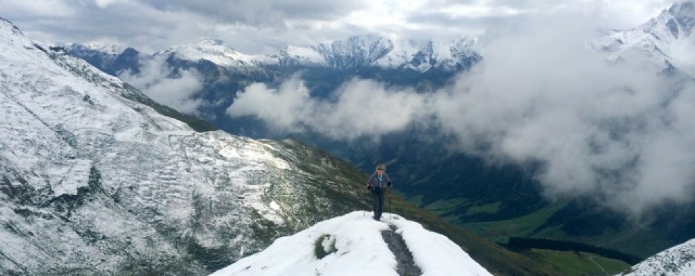
One of the problems with spring hiking in our area is when does the snow melt?  Generally it’s on the southern exposures first, so we pick trails that are south facing and tend to be below the snow line.

One thing I forget each year is that just because it’s on the south side and below the snow line, it doesn’t mean that it’s smooth hiking.

Winter conditions have persisted in Durango and Colorado in general above 10,000 feet so we’re limited mostly to out and back trails. We hiked, however, on Monday, a loop trail leading up to Missionary Ridge and three miles across, to come down another trail back to the car.

In 11.3 miles we photographed (documented for a trail crew with waypoints on GaiaGPS) 61 trees blocking the trail.  Hikers never have a problem with downed trees, but the US Forest Service likes to keep these trails open for horseback riders.


In the five years I’ve been a WIS volunteer, we’ve never seen so many downed trees.  It’s primarily a factor of the 2001 forest fire which killed most of the trees in several sections of the trail, but the new growth is now coming up splendidly, as you can see in the background.  We also do a little erosion control, but without an ultralight shovel we can’t do much.


My favorite photo of the day was finding the trail marker for the return trip laying on it’s side at the top of the ridge.

In trying to figure which trails are open already this year, we find that we are recording trail conditions rather than giving advice on the Wilderness.

And for Public Lands Day I volunteered on the Sky Steps Project placing 500+ steps from City of Durango to Fort Lewis College, a 250-foot rise from the valley floor to the college rim. It’s a Trails 2000 project that will take several months to complete.

There has been a hillside trail for almost 25 years in this area, but this is the first time someone has endeavored to put in a bona fide stairway.  It goes fairly slowly as they are using 6×6″ rough cut beams for the construction, with rebar anchors and 12″ screws between the timbers.  Volunteers are doing all the work, which amounts to surveying the route, clearing the trail, cutting the steps, filling the voids with rocks before adding road-base filler, and then grooming the edges.  Our efforts were able to fill in about 60′ of rocks and road-base, plus add 3 small sections of stairway totaling about 30′. Believe it or not, this took almost 30 people, carrying timbers to the site, foraging for stone filler, “fire lining” buckets of gravel to fill the stairs, and grooming the hillside.  They have still another 200′ of stairway to build and all the filler to make it usable. (Photos courtesy of Trails 2000 – I forgot my phone)


Two Days in the Bears Ears

Mike and I made it over to the Bears Ears region to see first hand some of the wonders that may or may not be a National Monument.  The panorama above is a small glimpse of the glorious territory between Canyonlands and the San Juan River.  Certainly not as deep as the Grand Canyon, but no less spectacular, as it’s close up and personal in it views.  This canyon shown is only about 3,000′ deep but looking straight down and across will give you pause, for more reasons than catching your breathe.

We spent a couple days down in the  Hammond Canyon, which unlike many of our hikes, starts out down and finishes with a very steep climb out.  Had we known more about this area we’d have gone in from Posey Trail and hiked out Hammond Canyon which is more gradual and a little less elevation.  But the “stashed” mountain bike at the top of Posey Trail made for an easy looped hike.

One of the features made the adventure even more delightful, besides the views, the freshly blooming Lupine, double waterfall and original growth trees, was a ruin.  An older trail guide mentioned a ruin visible from just below a waterfall, we missed from the first waterfall we found.  It wasn’t until we’d taken a 45 minute bushwhack and returned to the creek a quarter mile downstream that we could clearly see the ruin.

This photo was taken about 2/3’s the way up a mostly animal trail to the ruin.  See if you can pick it out when you enlarge it.  Only about 700′ above the valley, but a third of a mile away it’s hard to see.

Once you’ve scrambled up to it, it’s quite impressive with it’s five rooms and very large hidden alcove behind it, littered with corn cob husks.  These remote and hard to find, let alone hard to access, ruins remain remarkably intact for being 1300 or more years old.  Well worth the effort, once you know where to look and climb.


It’s called “Three Finger Ruin” which is named from the eastern view of these three towers visible from the down stream view.  Coming in from the west these signature towers are distinctive enough to locate the ruin. One thing we realized just as we climbed out of the canyon floor was that this hidden micro-climate was almost the same elevation as Durango.


Camp was more than comfortable, and came with the waterfall ambient noise as a backdrop.

And in case you wondered what the solar barn raising scene in Durango was, here a 36 panel 11.2kW system we put up just before leaving for the Bears Ears.


Busy April

Suddenly, all the things on your to-do list are lined off and it’s time to start thinking about a new list. But you want to take a pause and not add anything right away so that you can relax in the lull.  That’s where we are just now.

Except for a small chip in the left-hand glass panel the shower is completed.  Without Joe’s help I’d still be in there laying tile.  Replacement glass will take another couple of weeks, but at least we can enjoy the shower now.

Five days of April were reserved for a Canyonland’s hike with UltraLIght friend Will and his Montana friends. The Utah desert is a place that you’d want to visit only a couple times in a year and April is one of them.  Day temps in the 70’s and nighttime in the mid-30’s made for a 50-mile exploration of some of the park’s hinterlands. Discovering new routes to link up trails is one of Will’s passions and we lucked out this time with two new routes confirmed.

Easter week is the busiest time of the year in this National Park with backcountry permits reserved months in advance.  However if you’re lucky enough to get one, the crowds completely disappear once you get beyond the day-hiking range.  We spent four days without seeing a soul, and only a two sets of footprints. Water is the big concern, and we were fortunate to have Will’s experience to tell us where to find those water holes.

The day after our return from the desert, I was scheduled to give a talk on GaiaGPS for the San Juan Mountain Association.  Gaia is a smartphone GPS mapping application that I’ve been using for four years, most recently on this Utah desert trip.

Will typically doesn’t need a map to orient himself in the backcountry, but confirming his location sure saves some misadventures into unknown side canyons.

Just like our UltraLIght talk a month earlier, we’d underestimated the attendance by 200%.  The Ultralight talk was standing room only and the Gaia talk had 60 people if you include me and the director.  As with all technical presentations, even though all the folks had the app in the class, they still needed practical experience.  So Saturday morning we took 20 of them on a “hands-on” hike to hone their skills.  One fact I brought out in the talk was that of the hikers our Search and Rescue group has searched for in the last two years, 9 of the 12 were day-hikers from Durango. Even locals get lost, and one testimony from a county native was that he got disoriented this winter only a mile from the road in the snowy hills near Andrews Lake at Molas Pass.  He wanted to have Gaia so that didn’t happen again.

GaiaGPS works everywhere, you might consider adding that app to your smartphone if you’re apt to venture away from the highway.

Still almost 10 days left in April and summer hasn’t even begun.


Back in the Desert

p1430712
img_6385
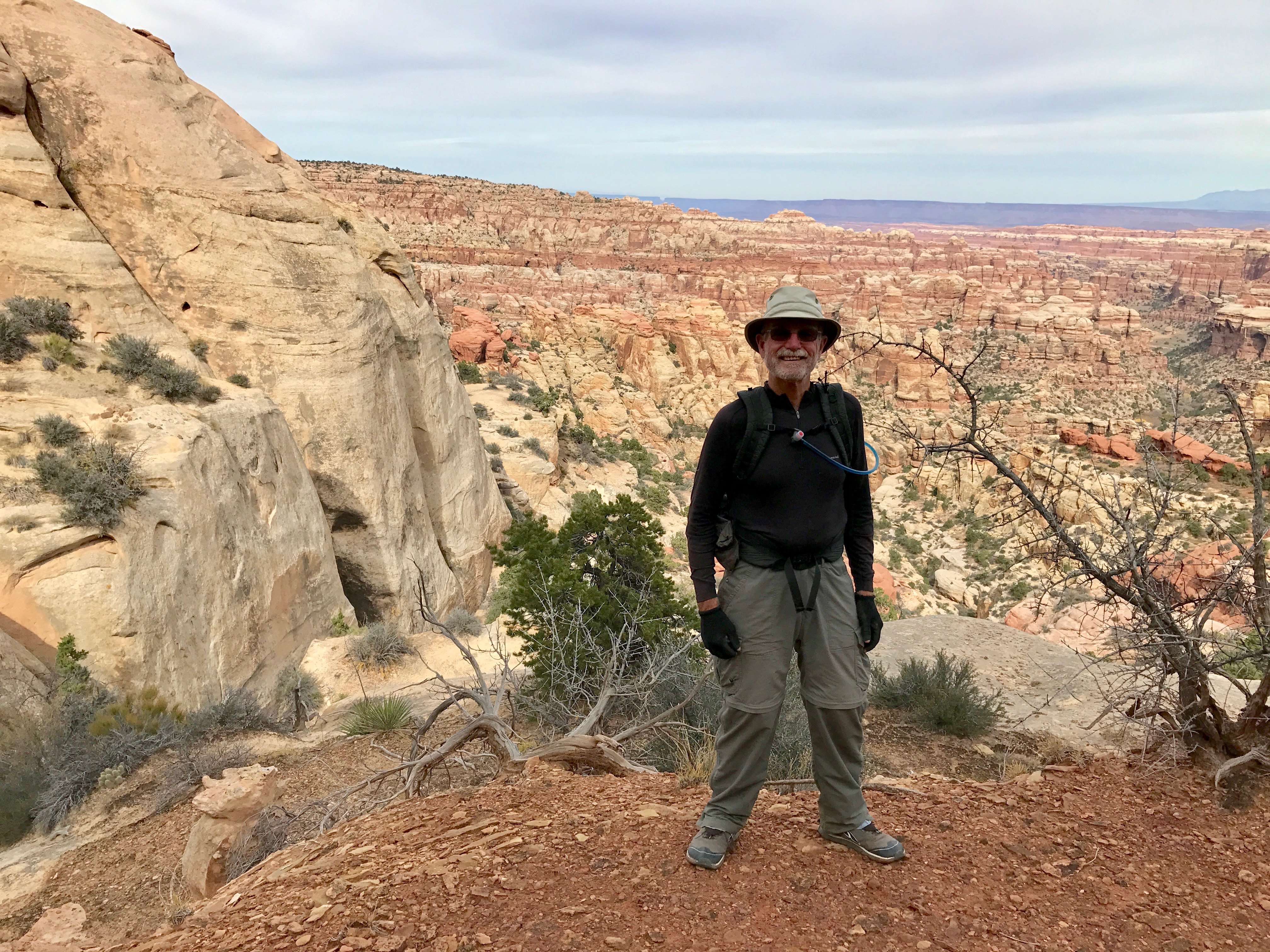
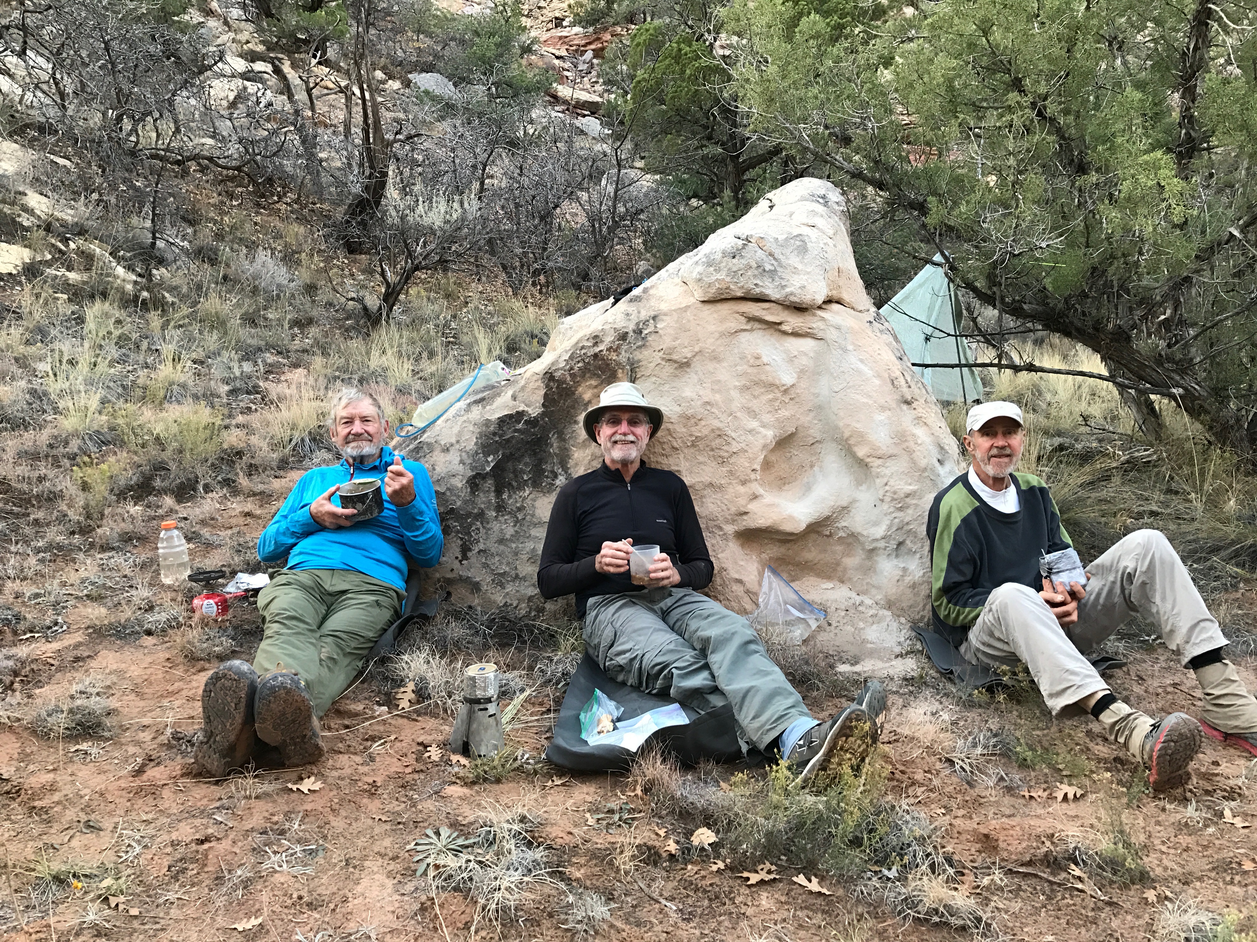
We managed one more 4-Day trip to the desert the last week of October. All three of us were eager to test some new gear and enjoy the end of our Indian Summer here in the Southwest.  The Utah desert is very popular this time of year and securing a backcountry hiking and camping permit is difficult in the Canyonlands National Park.


nationalparkWe learned in Spring that we could come into the very bottom of the National Park (green shading) as day hikers, by entering and exploring the Butler Wash Wilderness Study Area directly south of the park. This area is some of the finest desert wilderness and deserves it’s special designation.

p1430695The only footprints in the four days were deer, bear and bobcat  (excluding the day hikes deep into the National Park where we only saw one set of human prints). Water sources are the primary reason no one goes into this region, but we’ve now scouted and recorded a number of water holes. Our trip itinerary is dependent on finding adequate water and each time we’re able to explore new canyons and routes until we run low and have to backtrack.

wf-ge

10/25/16 East Fork of West Fork Salt Creek


img_6400Because we’ve seen numerous bear tracks and scat in the drainages that we travel and camp, we always hung our food.

Will and Mike both had new packs to test.  Mike’s was a new version of zPacks “front zip” backpack, and Will is always testing and reviewing new pack designs for Gossamer Gear. This trip Will’s pack was a new, soon to be released, 55-liter lightweight backpack. I was able to test out my newest ultralight shelter with it’s dual doors open. However the very best addition was bringing a new UL 1.75 oz pillow. The pillow combined with a “hip hole” in the sand made for the most comfortable sleep I’ve ever had on the ground. Overnight temps were 40° and daytime temps were low 60’s, perfect weather for desert exploring.

img_6386

Typical camps.
p1430681

Our track went thru narrow drainages and over bands of layer rock formations.p1430689

p1430739

As usual, a Good Time was had by All. And in little over 4 weeks we’ll be in Thailand.

img_6399

Reworked my UltraLite Gear page and added an online UL Gear worksheet in case you’re curious.

Escalante 2016

P1010957The Escalante Legacy Tree Study lives on, with our most recent trip to the desert duct delivering the Dixie National Forest waters thru the high Utah desert to the Colorado River at Lake Powell.  The Escalante River is said to be “navigable” sporadically during the Spring runoff, but it’s more like a shallow creek most of the year, especially in August.

Mike and I have been lucky enough to be invited to assist Melissa, a research and restoration ecological biologist specializing in Southwest and desert environments, the last two years on the Escalante River, and in the past in the Grand Canyon. The Escalante Legacy Tree Study finds and catalogs those historic trees in the Escalante drainage that meet a specific criteria, not just size. As the GaiaGPS track segment shows, this involves searching both sides of the river banks for qualifying senior candidates.

Track

P1010950Since the access is either down the river along the seldom used animal trails or over the high desert and into the canyon thru steep access, not many get to experience the verdant micro-climate winding thru the desert crust. It took a full day just to get to where we left off last year, route-finding our way to a slot in the canyon wall and bushwhacking down the river bank.

P1010954

Unusually cooler temps for this time of year made the week working in the Utah desert tolerable and mostly pleasant.  My original plan to not take a sleeping bag was fortuitously amended at the last minute, because the pre-dawn temps were in the mid-50’s rather than the anticipated mid-60’s.  Day-time temps never broke triple digits in the canyon and since we were mostly in the trees and often making repeated river crossings in the P1020070
water, we were comfortable in the long sleeves and long pants necessary for bashing thru the undergrowth. This isn’t a trip that boasts high mileage as the entire goal for the week was to log trees in just a five-mile section of the river.  It takes a full day to search about a mile of river: finding a tree, logging it’s height, distance from and height above the river, GPS location, health, number of stems, girth, and the species (plants) surrounding that granddaddy.

P1020059We spilt up when the river bank is larger than we can see thru the foliage, using coded yodels for communication and then gathering around when we find a living heirloom, each taking a series of recording chores. Melissa managed the most difficult, bushwhacking a direct route to the river to establish distance from the water. Mike and I counted stems (trunks out of the ground), girth and struggled with identifying species IMG_5771surrounding the tree. By mid-day many of the long slender plants started looking very much the same. Pictured is the list of common names we encountered and the code we needed for logging a tree’s vegetative environment. An interesting TED talk describes how plants communicate and share below the ground (worth viewing). We also needed to photograph the tree with ID number, which involved hiking back far enough thru the brush to find a suitable profile.

There are always interesting things to see besides legacy trees.  This river P1020020canyon was home to many in past centuries, just as all the other canyons and deserts of the Southwest.  In one alcove above an early twentieth century cowboy settlement, we stumbled upon an Indian settlement and granary with corn cobs and pottery shards.

A good time was had by all and we look forward to another section of the river next year.

To make sure I don’t bring the same Version 2pair of worn out hiking shoes I did the same gesture I used to do leaving a boat yard in the past. This dumpster was right next to the first ice cream stop out of the desert.


WIS Trip Report

IMG_5707Not all the backpacking trips this summer have, or will, cover as much ground as the Weminuche Traverse posted earlier.  The photo above shows us at Fuller Lake in the late afternoon where we camped at 12,800′ the first night of a three-day WIS trip to the Ice Lake Basin.

This photo alone could foster 500 words about the trip, but this was a WIS (Wilderness Information Specialist) trip and it might fitting to just show you our trip report for those 3-days.  As the detail states this trip had the most “hiker interaction” we’ve ever experienced, mainly because we don’t frequent these hike traffic area as often.  This trip was fun and worth sharing.

WIS Trip Report — Tom Galbraith & Mike Taylor — July 29-31, 2016

Route:
Day 1 Drove to South Mineral Creek Trail head. Hiked up Ice Lake trail thru lower Ice Lake campsites, up to Upper Ice Lakes and on to Fuller Lake basin.

Day 2 Hiked up to Diamond Mine site down thru Lucy Mine back along Upper Ice Lake to Island Lake.IMG_5708

Day 3 Island Lake down to Ice Lake Trail and out at South Mineral Trailhead.

Trip stats: 3 days, 15 miles hiking, driving 120 miles

Executive Summary:

There were hundreds of hikers using the Ice Lake trail not just on weekends but on Wednesday (Tom’s wife hiked it on Wed 7/27 and there were at least 30 hikers lunching at Upper Ice Lake and close to 100 on the trail) and Friday this summer. It may be time to consider having/asking WIS volunteers to visit the Ice Lake Basin just as they are encouraged to visit Chicago Basin. The response from all but one of the hikers was “glad to see you up here” to “thank you for being here”. (One solo backpacker didn’t want to hear anything from us).

Trip Report:

  1. South Mineral Trailhead Parking lot was full at 7:30 AM
  2. Talked with 20+ people on the 2.8 mile uphill stretch to Lower Ice Lake Basin
  3. IMG_5703Walked thru every campsite in the lower Ice Lake Basin filling our trash bag with mostly aluminum from firepits, found tent stakes, socks, underwear, stove parts, an abandoned backpack stuck/snagged high in a tree, lots and lots of uncovered toilet paper (only twice associated with feces) and a freshly cut pine bough shelter with nylon cord tightly wrapped around small trees for ridgelines.
  4. Filled the small backpack with our almost 6 pounds of trash and talked father and son day-hikers into taking it down with them.
  5. By this time (noon) we’d seen close to 50 hikers on their way to Upper Ice Lakes.
  6. Checked on one young lady reportedly vomiting along the ledge trail to Ice Lakes. She appeared to be better at lake side, she had eaten something and had 3 liters of water. Declined any help and wasn’t going down until they got to Fuller Lake (Checked on her later in the day, she was fine)
  7. No one camped at Upper Ice Lake but several backpackers had come down as we came up.
  8. Before we left Ice Lake on Friday noon there were over 25 people enjoying the lake. Talking to most groups, they seemed to be either from Grand Junction or Albuquerque.
  9. At Fuller Lake we saw another 18 hikers that afternoon, four groups fishing, only one fish caught and released even though we could see numerous large (12”) and 6”+ fish swimming along the shoreline. Curious behavior (several hours) of a number of fish in shallow flats we thought might be spawning rituals.
  10. A couple from Grand Junction climbed Fuller peak while we were there.
  11. Version 2Saturday was the busiest by far in the Upper Ice Lake basin. By 10:30 there must have been 40 people there with more people streaming over the knoll the longer we talked with folks. It wouldn’t be too much of an exaggeration to say there were over 100 people who visited Upper Ice Lake basin on Saturday. Several took a dip, it looked more like the beach at Navajo Lake than Upper Ice Lake.
  12. One Denver photographer had pitched his tent Friday night about 40’ from the lake and we advised him of the 100’ regulation.
  13. On Saturday there were five tent camps in the Upper Ice Lake basin by noon.
  14. Almost every group we passed had a question or two about the lake or the area. The most frequent question was why is Ice Lake so aquamarine, turquoise or “tat color”. Next frequent was how to get to Fuller Lake or even Island Lake.
  15. At Island Lake we helped an international couple choose an alternative route down the mountain, rather than climb over the exposed rock between Ice Lake and Island Lake.
  16. Another family was trying to exit Island Lake via the outflow creek ravine rather than on the Grant/Swamp trail the Hard Rock 100 runners use. They were happy to learn there was an easier descent.
  17. After dinner and during a thunderstorm there were still people visiting Island Lake and at least four up on the ridgeline between Island Lake and Clear Lake.
  18. Sunday morning there were well over a hundred people ascending the Ice Lake trail: at least two backpacking groups, one totally overloaded.
  19. IMG_5718We checked a campsite north of the trail on a knoll below Lower Ice Lake basin and found a tent with an unattended fire with 6” and 4” logs burning. After no one responded, we extinguished the logs by carrying them down to a creek. We left a polite note asking them to be more careful in the future.
  20. IMG_5720On the trail down we were alerted to a Hotchkiss family group with an elderly lady experiencing problems getting down and her 16 year-old granddaughter was carrying two backpacks. (They’d overnighted in Lower Ice Lake basin for two nights.) It took a long time to catch them because almost every group coming up had something to say or ask. After learning the ailing lady wanted to walk slowing down by herself we offered to carry her backpack down.  Mike went back up from the trailhead 1.5 miles to check on them once again. He carried a second backpack and stayed with them all the way down.
  21. Just above the “log creek crossing” we found a couple and two young children “scaling hand over hand” 100’ up from the creek crossing having missed the trail to the left of the creek. We blocked that bottom trail with downed trees so others might not choose the “elk trail”.
  22. We counted 91 vehicles in the parking lot while waiting for the ailing lady and about 12 of those switched out, all before noon.

IMG_5716This was the most rewarding day as a WIS volunteer I’ve had in four years as a volunteer. Everyone was happy to see us and talk. The exposure for the National Forest Service was excellent and 6 or 8 of the locals asked how they might learn about the WIS program. We learned late Saturday afternoon there was another “Forest Service” couple on the Ice Lake trail. We suspect it was the Schmaltz’s from Silverton since they’ve adopted that Ice Lake trail, which was in excellent shape. The trail looked liked it had been swept clean, in the lower section up to the log creek crossing. Hardly any micro-trash on the trail, but the trees and hidden spots are alive with TP.

As mentioned above in the Exec Summary, it might be a good thing to encourage more of the WIS volunteers to go up to Ice Lake and give Charlie and Paulette a hand. From noticing and hearing about Engineer Mountain trail the same might apply. The day hiker seems less experienced on those trails than those who visit Chicago Basin, and our help and volunteers might be needed as much on those two popular trails as in Chicago Basin.

Weminuche Traverse

Messages Image(3109858939)I was privileged once again to follow along one of Will Rietveld’s epic treks across the Weminuche Wilderness area of the San Juan National Forest.

Will has been hiking the San Juan’s for over 50 years and at 74 he doesn’t carry a map any longer, since just about every trail and mountain has  been etched in his memory.

As I’ve mentioned in earlier blogs, Will is a writer who reviews and tests ultralight gear from various vendors and has a blog UltralightInsights featuring that gear and his tips.

This year Will’s friend, the founder of Gossamer Gear Glen Van Peski came along as well.  They’ve hiked the Weminuche several times in the past, so it was fun to hear them revisit those previous trips.

IMG_5676Will generally only uses the normal trails to and from the Trailheads.  He prefers Elk trails and often times “bushwhacking” to get where he’s planned to hike.  When I say we probably climbed 3 or more passes a day it’s not an exaggeration. The couloirs between peaks is how he likes to traverse the alpine landscape and usually there’s only been four-legged animals before us.

IMG_5618

DSCF0027As you might imagine, the views are spectacular, and above 13,000′ you can generally look in any direction. Camping above tree line we never need worry about insects or bears. The wildlife we saw was primarily Elk in herds and pairs, a number of curious mountain goats, a lumbering porcupine and countless ptarmigan with their chicks. We did see at least 3 bald eagles, one perched on a stunted spruce watching over the fish in Lost Lake.

Version 2


Ostensibly this was a fishing trip.  Those who know me know fishing isn’t my forte, in fact I just don’t fish because I’ve lost more lures and flies than I’ve ever landed fish.  But there was a novel fishing rig along and I was keen to try my hand: a TicTac fishing rig that Glen brought along as his UL fishing kit. I didn’t get a chance to weigh it but I’m sure it was just over an ounce.

DSCF0066IMG_5681 I caught four fish that day, probably more than all I’ve ever caught in fresh water. (Trolling for Tuna, Dorado or Mackerel off Paradox excluded). I only kept one 16″er and could only fit DSCF0064half in my beer-can pot Esbit stove for dinner, so I dried the rest Thai style on my pack for the next 3 days and enjoyed dried Cutthroat Trout.  I’m hooked and already have a TicTac box of mouth freshners to build my own fishing kit.


DSCF0069

P1420975The six-day trip was challenging in that we covered 60.2 miles, which itself would only be 10 miles a day, but we managed 19,990′ ascent and 22,081′ descent in that distance.  One day was just over 14 hours. We didn’t anticipate as much snow as there was this time of year and had to alter route, glissade and scree-slide more often than we figured.

Good thing that each of us was packing UltraLight gear, averaging between 7 and 9 pounds base weight.  Six days food at 1 ½ pounds a day was as much as our base weight.  Glen is a master UL hiker and showed us a few of his tricks which I’ll try and incorporate in my kit for the next trip.

By-the-way, most of these photos are from Glen and Will’s cameras as I wasn’t taking many photos in an effort to see how long my iPhone 6+ would be able to track our daily routes.  GaiaGPS tracked 58 hours of hiking and only needed a short charge on the 5th day. As a result we’re now able to “fly” our track in Google earth for some exciting views.

DSCF0072

Here’s the crew, Will on the left and Glen on the right. Will and I logged Wilderness Informational Specialist credit by wearing our volunteer shirts and talking to the backcountry hikers and climbers we ran into.  The trip basically took us from Durango to Silverton, zig-zagging thru the Weminuche Wilderness area. For Glen’s version of the trip click here.

Here’s a few more photos to give you a sense of the adventure.

DSCF0033 DSCF0029 P1420901 P1420915 P1420946 P1420943 DSCF0023


Walking the Talk

IMG_5642July has been unusually good weather in the San Juan’s for hiking this year.  Typically the monsoons start on July 4th, but this year we’ve managed about 15 days without a single rain drop. Not that we’ve hiked every day so far this month, but between the two of us we’ve got in at least 15 days on the trails. From a two hour training hike with my sister Donna and niece Vanessa (with 19#, 8 month-old, Oliver on her back) to an epic 6 day traverse of the Weminuche, with lots of miles in between.

IMG_5635Stanna has up’d her hiking regime to M-W-F with her Ladies Hiking Group, tackling harder trails on Monday and Friday with those ladies who want the additional exercise. She even took me on one hike the morning of the 4th.  I could barely catch her at the parking lot when I tried to add another ¾ mile to the Cascade Creek waterfall inbound leg.  In 4.7 miles back  I didn’t see her until I had sight of the car and her at the same time.

IMG_5629In prep for the UL trip in the Weminuche (see next post) I managed an easy peak climb in the La Platas, with Will Rietveld and Travis Ward where we saw a mountain lion and almost stepped on a 2-day-old fawn.IMG_5627


I’m not a peak bagger, but I did sign the log books on two peaks in the last 10 days, none of them 14’ers but they seem to have jars with logbooks on most mountain tops over 13,000.

IMG_5618Since Stanna and I both use GaiaGPS, she has been able to follow some of the tracks I’ve recorded with her hiking ladies. As WIS volunteers, I did the Snowdon Notch right after my aborted Colorado Trail attempt (to establish it was my new trail shoes that foiled the CT, not my body) and she and her group visited the same trail several days later.

Sure wish we could take some of you along.  The mountains of Southwestern Colorado are beautiful this time of year.  See if you can join us.


GaiaGPS Gear Review

GaiaGPS LogoGaiaGPS is the single best App I’ve ever purchased, and that’s coming from a parsimonious Scots miser who hasn’t purchased more than a dozen App’s for his smartphone, and those few all under $3.

Let’s just get the price issue out of the way at the onset: it costs $19 from the App Store for iOS devices and at Google Play for Android devices. If the cost puts you off from trying this invaluable backcountry App, then find someone who’s using it and get a first-hand demonstration, or visit the GaiaGPS website to view a demo.

GaiaGPS has extended my hiking and backpacking experiences many-fold since I first saw another hiker using it on the trail. He was following a track someone had given him, recording his own track with all the real time stats, all the while viewing his current location on a clearly visible fully-zoomed USGS topo.

Questions immediately came to mind: What does it cost? How much are the topos? How large is the app? How do you get other people’s tracks? Does it eat up your smartphone battery and what was that name again? (It’s GaiaGPS).

I’ll have to admit I had to look up “gaia” on the internet; its The ancient Greek goddess of the earth, mother of the Titans, in case you’re clueless as well.

IMG_5520I’ll also admit more than once I’ve been “off track” when hiking and backpacking. Now with GaiaGPS on my smartphone it happens less often, or more to the point, for not as long. Having a real-time GPS cursor following my footsteps is a pretty amazing feature to have in my pocket.

GaiaGPS on a smartphone doesn’t use or need cell tower availability or coverage, rather it uses the phone’s internal GPS chip. It works anywhere in the world, unless you’re in a deep dark canyon with walls that obscure most of the sky. My GaiaGPS recorded tracks seem to do just fine in dense forests and wooded areas but will jump diagonally off track when it’s bouncing off steep walls and cliffs, righting itself once it can “see” more sky.

The phone stays in my pocket (or hip belt) until I’ve sensed I’m off track, have an intersection choice to make, or just am curious how far we’ve gone. But GaiaGPS can tell you much more if you choose: such as knowing the distance, altitude, moving time versus your total time, average speed, and stopped time, to name a few.

What really pleases me is that I now have all those GPS features combined with a camera and phone. I’ve eliminated my Garmin Trek’s 5.1 ounces (that I rarely used) along with 4.75 ounces for my point-and-shoot camera and consolidated those functions into my iPhone. The 9.85 ounce savings allows other gear, or better yet cutting my base weight down closer to that elusive 10-pound number.

And just as preparing for an adventure is enjoyable and rewarding, checking out my tracks and stats after the hike has added to my overall joy of backpacking.

Sharing the track is fun as well. You can export the track via email or text message as well as import it into Google Earth or other mapping applications like Garmin Base Camp. I often take a screen shot of the imported Google Earth track and place it in my blog to give folks a sense of where I’ve been hiking.

Just buying the app can be a little intimidating and even frustrating if you don’t know how to use it to its full potential. GaiaGPS offers you all the USGS topos for the United States for free, as long as you are online (connected to WiFi). You must select an area (draw a box around and Save) the region you’d like to have on your phone while you’re still online.

GaiaGPS screen shotsThe features and operation are very straight forward, but it takes a little exploring to figure that out without someone showing you or watching the numerous very short how-to videos offered in the Help Section of their website.

You can certainly Record a Track without a single bit of help and download the map tiles after-the-fact, but if you’re actually trying to navigate with a topo offline you need to have those USGS (or other versions of the many maps provided) loaded beforehand. Users new to the app complain of “blurry” topos when in reality they haven’t downloaded the actual map tiles and are just seeing the default low resolution overview map.

IMG_5521There is a long list of features provided with the basic version, but the overall beauty of the app is having a super clear, zoom-able topo of where you are traveling and the GPS cursor arrow marking your current location. If you’ve started recording your track, the line of travel is shown in a contrasting color telling you where you’ve been and possibly how far off track you might be.

I especially like loading up someone else’s track for a hike or ride, and using that to show me the route I’m planning to travel. That feature is as easy as emailing yourself the previous track (from a friend or off the internet), tapping the attachment and selecting Import to GaiaGPS. It loads in your GaiaGPS Folders section and you can “Show on Map” with the press of a button.

IMG_5625After using GaiaGPS and collecting numerous tracks, I really appreciate the easy way I can organize the various tracks into Folders, making finding and utilizing previous tracks far easier.

This app could be something you didn’t know you needed, but it soon will be something you can’t live without. Especially if it helps get your pack weight down by eliminating an extra device. As mentioned earlier, GaiaGPS has numerous short and to-the-point video tutorials (https://help.gaiagps.com/hc/en-us/categories/202519108-iOS), in the Help section of their website online, for each feature. Check it out; you’ll like it.


Time to hit the Trail

IMG_5610UPDATE: seems that the new trail shoes I wore need more than a day break in.  They are ZeroDrop and might be the reason I had hip pain after the trail turned uphill at 9 miles. Fortunately Stanna was still in Denver the next day and picked me up after 17 miles.  Another day for the CT.

Original Post: In the spirt of “how many summers … left,” it’s time to hit the trail again. The CT has been a nagging specter in my backyard ever since I started UltraLight hiking. And since summer is more than half over for some of us, now is the time to get that ogre taken care of. The hike shouldn’t be a problem: it’s the prep and logistics that is so onerous.

Matt Zion – Version 6It’s first presence was that young fellow I met 17 days out of Denver with a base weight of 7 pounds. With his UL zPacks pack and umbrella tucked in the side sleeve it, he made the the trail seem easy. He was zipping along the Colorado Trail making 33 miles a day. I tried to see what that pace was like a couple years back, and don’t want to try that again. It was easier to mimic his base weight than do that back-to-back mileage, but he had 50 years on me, or better said, “off me”.

Here’s the trail, since it’s hard to imagine.

CT One Line

IMG_5613Food; the quantity and logistics of arranging “drops” is the most work, especially if you decide to hike the CT at the last minute. A sensible thru-hiker would plan this 24+ day adventure well in advance, packing and sorting caches for various stages along the route. But…

Some of us UberLite HDD types try to sort it in a weekend.  Fortunately I’ve got a previously arranged commitment two weeks into the trail so arranging for half the drops could be postponed, but all the meals got packed from the stores covering two table tops.

The Menu honed over many other UL trips:

MenuCT

There won’t be many blog posts while I’m in the backcountry, however you can follow the track live by watching my Spot track.