Escalante 2016

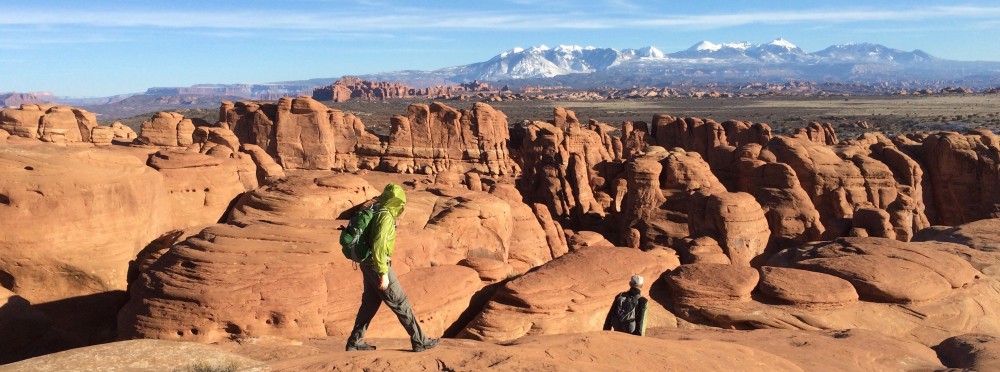
P1010957The Escalante Legacy Tree Study lives on, with our most recent trip to the desert duct delivering the Dixie National Forest waters thru the high Utah desert to the Colorado River at Lake Powell.  The Escalante River is said to be “navigable” sporadically during the Spring runoff, but it’s more like a shallow creek most of the year, especially in August.

Mike and I have been lucky enough to be invited to assist Melissa, a research and restoration ecological biologist specializing in Southwest and desert environments, the last two years on the Escalante River, and in the past in the Grand Canyon. The Escalante Legacy Tree Study finds and catalogs those historic trees in the Escalante drainage that meet a specific criteria, not just size. As the GaiaGPS track segment shows, this involves searching both sides of the river banks for qualifying senior candidates.

Track

P1010950Since the access is either down the river along the seldom used animal trails or over the high desert and into the canyon thru steep access, not many get to experience the verdant micro-climate winding thru the desert crust. It took a full day just to get to where we left off last year, route-finding our way to a slot in the canyon wall and bushwhacking down the river bank.

P1010954

Unusually cooler temps for this time of year made the week working in the Utah desert tolerable and mostly pleasant.  My original plan to not take a sleeping bag was fortuitously amended at the last minute, because the pre-dawn temps were in the mid-50’s rather than the anticipated mid-60’s.  Day-time temps never broke triple digits in the canyon and since we were mostly in the trees and often making repeated river crossings in the P1020070
water, we were comfortable in the long sleeves and long pants necessary for bashing thru the undergrowth. This isn’t a trip that boasts high mileage as the entire goal for the week was to log trees in just a five-mile section of the river.  It takes a full day to search about a mile of river: finding a tree, logging it’s height, distance from and height above the river, GPS location, health, number of stems, girth, and the species (plants) surrounding that granddaddy.

P1020059We spilt up when the river bank is larger than we can see thru the foliage, using coded yodels for communication and then gathering around when we find a living heirloom, each taking a series of recording chores. Melissa managed the most difficult, bushwhacking a direct route to the river to establish distance from the water. Mike and I counted stems (trunks out of the ground), girth and struggled with identifying species IMG_5771surrounding the tree. By mid-day many of the long slender plants started looking very much the same. Pictured is the list of common names we encountered and the code we needed for logging a tree’s vegetative environment. An interesting TED talk describes how plants communicate and share below the ground (worth viewing). We also needed to photograph the tree with ID number, which involved hiking back far enough thru the brush to find a suitable profile.

There are always interesting things to see besides legacy trees.  This river P1020020canyon was home to many in past centuries, just as all the other canyons and deserts of the Southwest.  In one alcove above an early twentieth century cowboy settlement, we stumbled upon an Indian settlement and granary with corn cobs and pottery shards.

A good time was had by all and we look forward to another section of the river next year.

To make sure I don’t bring the same Version 2pair of worn out hiking shoes I did the same gesture I used to do leaving a boat yard in the past. This dumpster was right next to the first ice cream stop out of the desert.


Grand Ol’ Time

P1010924

What goes on on the river, stays on the river, until the photos start showing up in Dropbox, that is. It probably isn’t hard to tell who didn’t get the memo about bringing a costume for the traditional costume party, but the gals anticipated it with a few extra tutu’s and a kimono.

P1010899Rafting the Grand Canyon on the Colorado River is one of the “must do’s” on most outdoor recreation people’s bucket list.  I’ve been fortunately enough to have done it six times now and it’s still awe-inspiring in it’s majesty and constantly thought-provoking in it’s creation. Relative concepts of time are shattered contemplating what’s transpired on earth as evidenced in it’s exposed layers and fossils.

P1420709Having lost the use of my iPhone camera has limited the accompanying photos to those posted in Dropbox so far.  Suffice it to say, our Maravia raft flipped (I wasn’t on the oars) early in the trip in a “hole” at Tanner Rapid.  Nothing was lost off the boat other than the two guys that swam the remaining ¾’s of that white-water rapid. The rafts are typically “rigged to flip” by lashing all the gear down with river straps and nets. In the time that it takes to corral the raft to the shore-line and get 10 people on top to “right” the raft, my iPhone (which was inside a small water-tight bag, inside a water-tight day bag) got swamped probably due to the weight and pressure underwater.

IMG_1790

A good time was had by all as you can see by the waterfall hike up to Elves Chasm where our group enjoyed jumping out of the cavern into the pool.  The 15-day trip was designed to maximize our hiking opportunities which are some of the best experiences along the P1010888river.  Many trails and slot canyons are only accessible from the river and as such, provide somewhat unique experiences, if you forget that 30,000 people get to float the “Grand” each year.  Since the traffic on the river is limited by permits, we often hiked without other groups and the camps are such that you might never see another group near your river camp.

The Little Colorado River confluence, Matkatamiba, Havasu and Deer Creek are the exceptions where the large commercial rafting companies always take their clients each day.  During the summer season there is only one private trip and four commercial trips launched each day.  The commercial trips are 7 to 10 days and move their clients quickly down the 225-mile river; many clients are helicoptered out after the famous Lava Falls Rapid experience at mile 179.

P1010900 (1)

Since this trip was primarily to support kayakers, the group rented five 18′ commercial-sized rafts with all the trip gear from Moenkopi Riverworks out of Flagstaff. Normally we’d bring our own 16′ rafts and gear but the group opted for a fully outfitted package: boats, gear and food.  Since it was a private trip we didn’t have any guides, cooks or swampers, providing all the “man-power” ourselves.  It was a new experience to see how a commercial trip is provisioned and outfitted.  Food and menus were great and our 16 members divided into crews of 4 to take turns preparing each day’s repast.

Google Earth Map shows approximately 225 miles from below the Hoover Dam at Marble Falls to Diamond takeout on the Hualapai Reservation.

Happy to be back home, but if you ever get an chance to “do the Grand” — private or even on a commercial trip — don’t pass it up.  It’s a once in a lifetime experience.

And I’ve now invested in a LifeProof case for my replacement iPhone.


iPhone is toast – wet toast

Halfway into the trip rafting down the Colorado River our raft flipped and the iPhone didn’t survive the 30 minutes upside down inside a water proof sack, inside another waterproof iPhone in Riceday bag.  Owner is fine. Rice-to-rice resuscitation didn’t bring it around this time, even after 7 days in the RCU.  I’ve ordered a replacement but that won’t happen for several days, therefore my phone won’t ring, nor be answered until I put the old SIM card in a new replacement iPhone.

Still available via messages or email.

Liquid San Juan

Moving a little too quickly lately, which hasn’t left much time for blogging. It was pointed out to us last week that we’re never completely offline or out of touch, but last week was an exception.IMG_5551

One of our favorite rivers is the San Juan River just southwest of Durango by 3 hours.  We used to run the San Juan every Memorial Day for years, with all our local rafting friends.  The habit was broken once we got hooked on sailing. The main motivation for rafting in those days was to get away from the hospital and the telephone.  It’s still possible to get out of touch when you go down a river, in fact the next two weeks on the Colorado thru the Grand Canyon will pose the same disconnect.

DCIM100GOPROFloat trips provide some of the best relaxation we can recommend. Of course there are moments of effort in the rapids but the San Juan has very few.  However there is one other drawback: In low water you have to pay attention to flow or you end up pushing the boat thru the shallowest sections.  We only got out to push a couple of times when we weren’t paying attention.


IMG_5553This trip was a very small group: eight folks in 3 rafts, a canoe and an inflatable kayak.  All folks we’ve rafted with previously.

It’s very hard to win a lottery slot on the San Juan River these days.  Fortunately Bill Atkins snagged a cancellation in late March for this time slot, allowing all of us to join him.


IMG_5557IMG_5558
Weather was cooler, with a little rain but not enough to dampen the camaraderie.  As always, the meals were superb with BBQ’d Teriyaki Chicken, Southwestern Beef Burritos and Tacos, Shrimp Panang Curry and Green Chili Chicken Stew, to name a few.  Rafting is the opposite of UltraLight camping as we literally bring the 3-tub kitchen sink for washing.

IMG_5560
Stanna cooked her Panang specialty with shrimp in a wok and we even managed a French Bakery Cheesecake for dessert one night.

Almost forgot to mention one of our favorite hikes on the San Juan is up Slickhorn Canyon thru the cascading pools of water.


IMG_5562

Now it’s time to leave again for the Grand Canyon. Should have some photos from that adventure coming up.


Legend Trees – Escalante River

Just back from 5 days “logging” legend trees in the Escalante Wilderness Area of Utah.  Actually we didn’t cut down a single tree, we recorded the location, elevation above the river, height, health, girth, number of stems and species in proximity to the “legend” trees in the Escalante River corridor.  We were a team of three, headed by veteran Grand IMG_2819Canyon botanist Melissa McMasters, who spearheaded the tamarisk removal and vegetation replacement program along the Colorado River thru the Grand Canyon.  Mike Taylor was one of her “star” volunteers and seems to learn when she’s got a trip or a project lined up.  Fortunately Mike needs a partner and I’ve been lucky enough to go along.

IMG_2801Melissa has the contract to do the entire Escalante River corridor and it’s going to take a couple of years to count and record the legend tree data for that entire stretch.  The Escalante River is popular and famous for it’s remote, wild and scenic desert beauty.  Most of the drainage is not easily accessible to hikers unless they’re prepared for rugged riverwallmulti-day backpacking, and since it’s become a Wilderness Area the trails have become almost nonexistent.  Occasionally it’s possible to run the river in smaller rafts or kayaks, but it’s normal flow is in fractions of a CFS.  When it floods with 1,000, 2,000 or even 4,000 CFS it runs wall to wall in many places but reportedly only for very short periods. You need to be constantly aware of the flash flood possibilities.  It was .86 CFS for us.

IMG_2797Mike and I were skeptical of the minimal mileage Melissa expected to cover each day, when she told us about her previous trips above our starting point.  Less than five miles seemed too little for a full day of hiking.  Well, we diminished even that small number of miles by totaling only 1.5 and 2 miles of river in a 10 hour day.  We did manage just over 5 miles hiking each day, but when you go back and forth, round and round, across the river and back all day long, it’s hard to get very far down the river.  Below is a screen capture of our track (Gaia GPS App on iPhone) for just one meander of the Escalante River.Untitled

BanksWe did manage 29.8 miles total, according to the Gaia GPS data, but as for data recording along the Escalante River, we only managed to knock off a little less than 7 river miles in 5 days.  The hike in was 5.5miles and the hike out was 4.9 miles, and those tracks weren’t spent recording data. So that leaves 19.4 miles of walking around 7 miles of river bank.  And walking isn’t the best descriptor, since the foliage and Melissadensity of vegetation along the river proper is more like desert jungle, with Tamarisk, Coyote willow, and Russian olive, not to mention 5 and 6 foot Rabbit Brush.  Just getting out of the river and up 6-to 8-foot shear vertical sand and grass banks provided plenty of slipping laughter.

IMG_2849Legend trees have to meet certain criteria: for Cottonwood it needs to be greater than it’s cohorts, in this case at least a meter in diameter, have deeply furrowed bark, at least two dead branches and meet a subjective criteria sometimes measured as a vocal “Oh shit, look at this one”.
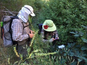
IMG_2802When you focus on trees, vegetation species, and go slower than the average adventurer, it makes for an extremely interesting and rewarding trip.  Mike kept us aware of the long forgotten Petroglyphs he noticed on the Navajo Sandstone walls, plus the numerous animal tracks reminded us we were only moments away from fleeing and feeding game who knew the trails far better than us.  It was a great trip in a very special Wilderness.

We all look forward to going back.SelfieIMG_2825And of course there’s always the “virtuous” reward meal…Strawberry Cheesecake milkshake, Mushroom Onion Burger and Onion Rings back in civilization.

For Mike’s photos in Picasa go to Mike’s Photos, and several of his photos are in this blog, since the iPhone was in a water-tight bag.

“If it’s snowing at the Put-in…”

IMG_0929Stanna has a saying from a river trip on the San Juan River, one March some thirty years ago, back in the last century: “If it’s snowing at the put-in, step off the raft and get back in the car and say: I’ll meet you at the take-out.”  This photo isn’t at the put-in, rather at the rendezvous point just outside of Durango last week.  Two inches of snow had fallen while we were loading the rafts for the trip to Green River, Utah, to run Grey and Desolation Canyons of the Green River.  Her advice could have applied.

It wasn’t a bad trip at all, just stormed and rained more than I’ve ever experienced on a P1010378river trip.  The online weather outlook was poor for the first day, “…high of 56 and low of 39 with 30% chance of rain…,”  but the remainder of the week to warm nicely with mostly sunny days according to the forecast.  We did have one nice day, thankfully, sunny enough to dare bathing in the river and drying off in the sun (while it lasted).

StillHowever, much of the time we were in long pants with fleece and rain jackets. We did manage a number of canyon hikes along the way.  One unusual site was a bootlegger still and cliffside rock cabin located in such a remote river canyon that we couldn’t figure out how he got his grain in and hooch out. This was situated 45 miles downriver halfway between two towns, but it was adjacent to an Indian reservation, so he wasn’t all that crazy.  Another site was the elaborate petroglyph panel featured below.

IMG_2239It was intimidating taking photos with my iPhone next to our trip-mate Jeff (note him in the bushes with his tripod mounted lens) and his Sherpa son carrying all his professional photography gear.  His Nature Revealed photography gallery is located in Durango and it was very interesting seeing him work and appreciating his “patience.”

IMG_2260Several evenings we had to cook dinner in the rain and warm ourselves with a fire in the firepan (a long-running requirement for campfires and BBQ’s in the river-permitted regions).

One particularly stormy, thundering loud and windy morning, I moved the camp stove under the teetering table and made coffee huddled on the ground below the collapsed “parawing” rain fly.  Luckily breakfast was just granola and yogurt with no need of a proper galley.

As unusual as the weather was for a mid-May desert river trip, so was the theme of the trips conversations.  Of the eight rafters, 4 were teachers with science backgrounds, one
of which enthralled and overwhelmed several of us with details about quantum mechanics (the science of the very small: the body of scientific principles that explains the behaviour of matter and its interactions with energy on the scale of atoms – Wikipedia).  “There are more atoms in a pebble than grains of sand on the earth,” “…everything is now regarded as a wave” and “all light comes from photons” –  just to give you a sense of the responses to our naive questions.  Electrons entered much into the camp and raft conversations, along with an ample portion of geology.  Learning was going all directions just like photons and electrons.

P1010331One mystery no one could explain, was just how beavers managed to chew through a number of trees almost 7 feet off the ground, near one of our lunch stops.  There was a large abandoned “lodge” close by and at least four of these higher trees lopped off above our heads.  No evidence of a perch or floating vantage point.  And snow doesn’t get that high at that elevation, even if the beaver wasn’t hibernating.

P1010335“My father wasn’t very careful with fire…,” is how one of the campfire stories started when Ed Zink livened up the sophomoric and socratic moods.  His jokes and limericks made for great company and balance to the 101-level non-traditional student questions firing back and forth to the professor.  Add in the great meals, side hikes and camaraderie, not to mention the wonder of drifting down a 90-mile section of one of the West’s remote desert rivers: this was a great trip.  Now if we could remember all that was taught and said, we’d have jokes and trivia for many more gatherings.

Breaking the Fun Barrier

IMG_6580John Wesley Powell reportedly used this iron-prowed skiff and ones like it on his 1869 exploration of the Green River in Utah. We travelled in far better skiffs, in fact I was the crew in a restored Grand Canyon dory owned by a Durango friend, John Lawson.  This dory was recognized by other rafters on the same river and John was told that there are photos of the Niagara running the Grand in a movie making the Art House film circuit, called DamNation.  This was my first time in a dory and I was lucky enough to row her and take her down a couple class 3 rapids.  The ride is much different than in a conventional raft because it only has a four-foot wide “wetted surface”.Niagara

DCIM100GOPROGreat trip, 11 people on 6 boats for six days.  Actually, the best trip I’ve ever had down the Green River thru Desolation & Gray Canyons because the heat and bugs weren’t an issue this time of year.  Forecast was for perfect warm weather, but high winds and night rains struck us several afternoons during our dinner gatherings.  Fortunately all the boaters were experienced and well-enough equipped to handle DCIM100GOPROadversities both on and off the river.  The pictured “para-wing” tarp covers the kitchen and most the galley.  Only one night did we have to have five people hold down the tarp as 35 MPH and higher winds whipped down the beach just after dinner.  As you can see in these photos, most of the camps were on sandy beaches which makes for easy camping.

For those who’ve never done multi-day river trips with a private group, the meals are divided up by boat and on this trip each boat was responsible for one dinner and one breakfast (lunches are individual since they don’t require a community kitchen).  It’s always a treat to see and eat meals the other boater provide for the group. Our “directives” were not to make very fancy or elaborate dishes so our crew made grilled pork chops, vegetable shiskabobs and mashed potatoes.  Cheese cake with berries for dessert. (We forgot to pull out the Cool Whip for topping.)

IMG_6591IMG_6588Lunches weren’t too shabby either.

Fun time on the river and evidently the same storm came thru Durango and shortened the Memorial Day traditional Iron Horse Classic to only 25 miles and none of the passes.  Glad I’d opted for the desert and hiking this year rather than training for the mountain passes.

And just because it doesn’t warrant a full blog on it’s own, I made a quick 2-day mountain backpacking trip just out of Durango IMG_6595behind the Purgatory Ski area the day after getting off the river.  We started high behind the ski area and hiked down the Little Elk Creek trail to the Hermosa Creek drainage, 13 IMG_6594miles, and then back up another trail further south called Dutch Creek trail.  It was fun once again being the first footprints on the trail after the winter snows melted.

We’d hoped to see lots of animals this early in the season.  Lot’s of fresh tracks and scat, but we only saw a young black bear scooting away at a speed I’d never thought possible.  When I asked about their mobility my hiking partner told me they can easily do 30 MPH and uphill at that.  Creeks were so high on the return up Dutch Creek that we had to ford with our shoes off three times.  Amazing how easy it is to get in a first-class backpacking trip in just two days only 30 minutes from home.

Middle Fork 2013

Argonaut

Once again we had the pleasure of rafting the Middle Fork of the Salmon, but this was one of the best trips ever. Even though the initial rigging and pre-camp was totally in the rain, plus the temps for day one were in the 60’s, it was a superb trip.  The 12 folks on the trip got along super, the food was great, the hot springs wonderful (we were the only one’s at Sunflower), we saw enough wildlife to write about, and the flows were just right at 2.6 to 2.9′.

Our trip leader was the only one who knew each one in the group before launch, but it didn’t take long for everyone to blend in.  One technique Ed Zink (an experience hunting guide) used to get folks to talk about themselves was his “Question of the Day”, where he asks, in round-robin, something like “What was your most interesting: River Trip/Vaca

tion/Childhood Memory”.  Within a couple days we knew quite a bit about everyone and had new ideas for travel, books to read and things to talk about.


Flotilla

Once the rains stopped, Idaho was slated for unusually high temps which we appreciated.  As the photo shows we had quite a variety of rafts, including 2 inflatable kayaks and a pack raft.  Best news was the old Argonaut’s most current patch job held the best ever.  No flips and only a couple rafts got “high centered” on rocks.


SunFlower Shower

Two of our favorite hot springs were completely vacant when we visited them.  And the trough shower at Sunflower is always a favorite even though you can’t use soap or shampoo.

One of those totally unexpected encounters happened as we arrived at Indian Creek.  Standing atop his raft as I pulled in, was my old high-school buddy Don Ahlert, who I cycled across the latter half of the Southern Tier of the US with in 2011.  Great to catch up with him before we each headed down river to meet up with our individual trips.  He launched one day ahead of us and was able to hook up a double permit for the Middle Fork and Main Salmon combined.

Elk Bar


Elk Bar is a totally sand beach where we tried to camp with Don Pole back in aught 11.  We made good use of the bar and even managed an extensive biology lesson watching a dozen randy frogs mating in the fish trap at the north end of the beach.

stuckey'sIf Ed asks us again “What was the best river trip you been on”, we’ll all have to say Middle Fork 2013 because when John Lawson answered about the most interesting place he’s ever visited in his travels, following answers such as, the Sistine Chapel, the Panama Canal and Ankor Wat, with “a Stuckey’s along the Kansas Interstate”, to which Ed laughed and cried for a very long, long time.  No one could speak again for hours without using the word “Stuckey’s” in their comment.


Middle Fork 2012

Lucky to land a spot on a Middle Fork of the Salmon river trip once again this summer.  Trip was a last minute cancellation that good friend managed to hook for June 17th.  Only 7 folks on the trip as water levels were high (above 5’ while recruiting) and it was such short notice.  Only four rafts and 2 kayaks.

One of the colder river trips I’ve been on, as the first couple of days had frost on our tents, but by the third day it warmed up and we could finish the trip in shorts for the last 3 days. At 4.68’ we only took 3 1/2 hours on the river each day to do 15 miles of white water and reach another wilderness camp site.

Met some interesting people along the way, one of which flew into a local river resort and hiked to one of the many hot springs we enjoyed.  They were Ozzy snowbirds who kept a Cessena 182 in Tuscon. We had much in common as he was a Master Captain for a 160’ motor sailer who visited many of the same places we did, just at a different level.  For example they would use the on-board helicopter to do their “check-ins”, a method that frankly never occurred to us when we arrived at a new port.

We didn’t see as much wildlife as in past trips, but the swallow-tail butterflies were out in the hundreds.  I’d never seen them congregate on a portion of wet sand beach before.  Our best guess was they were sucking the moisture out of the sand.