Deso-Grey Canyon

Here are some photos of my recent Deso-Grey Canyon trip.  A really troubled turkey spent a day with us.

Another photo of the really deep canyon.

(click here to expand)

Good friends at the BBQ, Mike and John.

What happens when you forget your glasses in your tent.


Two Days in the Bears Ears

Mike and I made it over to the Bears Ears region to see first hand some of the wonders that may or may not be a National Monument.  The panorama above is a small glimpse of the glorious territory between Canyonlands and the San Juan River.  Certainly not as deep as the Grand Canyon, but no less spectacular, as it’s close up and personal in it views.  This canyon shown is only about 3,000′ deep but looking straight down and across will give you pause, for more reasons than catching your breathe.

We spent a couple days down in the  Hammond Canyon, which unlike many of our hikes, starts out down and finishes with a very steep climb out.  Had we known more about this area we’d have gone in from Posey Trail and hiked out Hammond Canyon which is more gradual and a little less elevation.  But the “stashed” mountain bike at the top of Posey Trail made for an easy looped hike.

One of the features made the adventure even more delightful, besides the views, the freshly blooming Lupine, double waterfall and original growth trees, was a ruin.  An older trail guide mentioned a ruin visible from just below a waterfall, we missed from the first waterfall we found.  It wasn’t until we’d taken a 45 minute bushwhack and returned to the creek a quarter mile downstream that we could clearly see the ruin.

This photo was taken about 2/3’s the way up a mostly animal trail to the ruin.  See if you can pick it out when you enlarge it.  Only about 700′ above the valley, but a third of a mile away it’s hard to see.

Once you’ve scrambled up to it, it’s quite impressive with it’s five rooms and very large hidden alcove behind it, littered with corn cob husks.  These remote and hard to find, let alone hard to access, ruins remain remarkably intact for being 1300 or more years old.  Well worth the effort, once you know where to look and climb.


It’s called “Three Finger Ruin” which is named from the eastern view of these three towers visible from the down stream view.  Coming in from the west these signature towers are distinctive enough to locate the ruin. One thing we realized just as we climbed out of the canyon floor was that this hidden micro-climate was almost the same elevation as Durango.


Camp was more than comfortable, and came with the waterfall ambient noise as a backdrop.

And in case you wondered what the solar barn raising scene in Durango was, here a 36 panel 11.2kW system we put up just before leaving for the Bears Ears.


Busy April

Suddenly, all the things on your to-do list are lined off and it’s time to start thinking about a new list. But you want to take a pause and not add anything right away so that you can relax in the lull.  That’s where we are just now.

Except for a small chip in the left-hand glass panel the shower is completed.  Without Joe’s help I’d still be in there laying tile.  Replacement glass will take another couple of weeks, but at least we can enjoy the shower now.

Five days of April were reserved for a Canyonland’s hike with UltraLIght friend Will and his Montana friends. The Utah desert is a place that you’d want to visit only a couple times in a year and April is one of them.  Day temps in the 70’s and nighttime in the mid-30’s made for a 50-mile exploration of some of the park’s hinterlands. Discovering new routes to link up trails is one of Will’s passions and we lucked out this time with two new routes confirmed.

Easter week is the busiest time of the year in this National Park with backcountry permits reserved months in advance.  However if you’re lucky enough to get one, the crowds completely disappear once you get beyond the day-hiking range.  We spent four days without seeing a soul, and only a two sets of footprints. Water is the big concern, and we were fortunate to have Will’s experience to tell us where to find those water holes.

The day after our return from the desert, I was scheduled to give a talk on GaiaGPS for the San Juan Mountain Association.  Gaia is a smartphone GPS mapping application that I’ve been using for four years, most recently on this Utah desert trip.

Will typically doesn’t need a map to orient himself in the backcountry, but confirming his location sure saves some misadventures into unknown side canyons.

Just like our UltraLIght talk a month earlier, we’d underestimated the attendance by 200%.  The Ultralight talk was standing room only and the Gaia talk had 60 people if you include me and the director.  As with all technical presentations, even though all the folks had the app in the class, they still needed practical experience.  So Saturday morning we took 20 of them on a “hands-on” hike to hone their skills.  One fact I brought out in the talk was that of the hikers our Search and Rescue group has searched for in the last two years, 9 of the 12 were day-hikers from Durango. Even locals get lost, and one testimony from a county native was that he got disoriented this winter only a mile from the road in the snowy hills near Andrews Lake at Molas Pass.  He wanted to have Gaia so that didn’t happen again.

GaiaGPS works everywhere, you might consider adding that app to your smartphone if you’re apt to venture away from the highway.

Still almost 10 days left in April and summer hasn’t even begun.


Back in the Desert

p1430712
img_6385We managed one more 4-Day trip to the desert the last week of October. All three of us were eager to test some new gear and enjoy the end of our Indian Summer here in the Southwest.  The Utah desert is very popular this time of year and securing a backcountry hiking and camping permit is difficult in the Canyonlands National Park.


nationalparkWe learned in Spring that we could come into the very bottom of the National Park (green shading) as day hikers, by entering and exploring the Butler Wash Wilderness Study Area directly south of the park. This area is some of the finest desert wilderness and deserves it’s special designation.

p1430695The only footprints in the four days were deer, bear and bobcat  (excluding the day hikes deep into the National Park where we only saw one set of human prints). Water sources are the primary reason no one goes into this region, but we’ve now scouted and recorded a number of water holes. Our trip itinerary is dependent on finding adequate water and each time we’re able to explore new canyons and routes until we run low and have to backtrack.

wf-ge

10/25/16 East Fork of West Fork Salt Creek


img_6400Because we’ve seen numerous bear tracks and scat in the drainages that we travel and camp, we always hung our food.

Will and Mike both had new packs to test.  Mike’s was a new version of zPacks “front zip” backpack, and Will is always testing and reviewing new pack designs for Gossamer Gear. This trip Will’s pack was a new, soon to be released, 55-liter lightweight backpack. I was able to test out my newest ultralight shelter with it’s dual doors open. However the very best addition was bringing a new UL 1.75 oz pillow. The pillow combined with a “hip hole” in the sand made for the most comfortable sleep I’ve ever had on the ground. Overnight temps were 40° and daytime temps were low 60’s, perfect weather for desert exploring.

img_6386

Typical camps.
p1430681

Our track went thru narrow drainages and over bands of layer rock formations.p1430689

p1430739

As usual, a Good Time was had by All. And in little over 4 weeks we’ll be in Thailand.

img_6399

Reworked my UltraLite Gear page and added an online UL Gear worksheet in case you’re curious.

Escalante 2016

P1010957The Escalante Legacy Tree Study lives on, with our most recent trip to the desert duct delivering the Dixie National Forest waters thru the high Utah desert to the Colorado River at Lake Powell.  The Escalante River is said to be “navigable” sporadically during the Spring runoff, but it’s more like a shallow creek most of the year, especially in August.

Mike and I have been lucky enough to be invited to assist Melissa, a research and restoration ecological biologist specializing in Southwest and desert environments, the last two years on the Escalante River, and in the past in the Grand Canyon. The Escalante Legacy Tree Study finds and catalogs those historic trees in the Escalante drainage that meet a specific criteria, not just size. As the GaiaGPS track segment shows, this involves searching both sides of the river banks for qualifying senior candidates.

Track

P1010950Since the access is either down the river along the seldom used animal trails or over the high desert and into the canyon thru steep access, not many get to experience the verdant micro-climate winding thru the desert crust. It took a full day just to get to where we left off last year, route-finding our way to a slot in the canyon wall and bushwhacking down the river bank.

P1010954

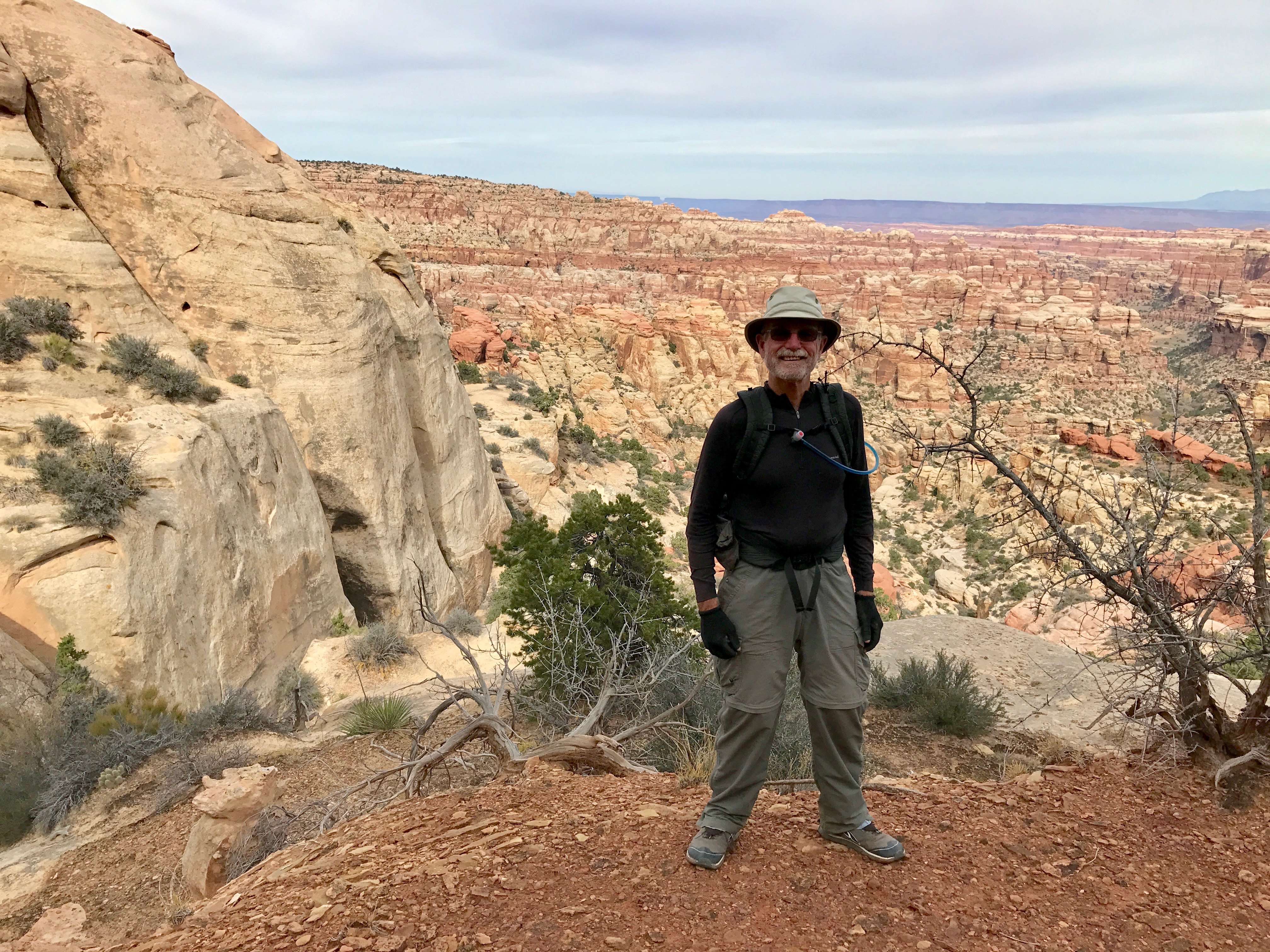
Unusually cooler temps for this time of year made the week working in the Utah desert tolerable and mostly pleasant.  My original plan to not take a sleeping bag was fortuitously amended at the last minute, because the pre-dawn temps were in the mid-50’s rather than the anticipated mid-60’s.  Day-time temps never broke triple digits in the canyon and since we were mostly in the trees and often making repeated river crossings in the P1020070
water, we were comfortable in the long sleeves and long pants necessary for bashing thru the undergrowth. This isn’t a trip that boasts high mileage as the entire goal for the week was to log trees in just a five-mile section of the river.  It takes a full day to search about a mile of river: finding a tree, logging it’s height, distance from and height above the river, GPS location, health, number of stems, girth, and the species (plants) surrounding that granddaddy.

P1020059
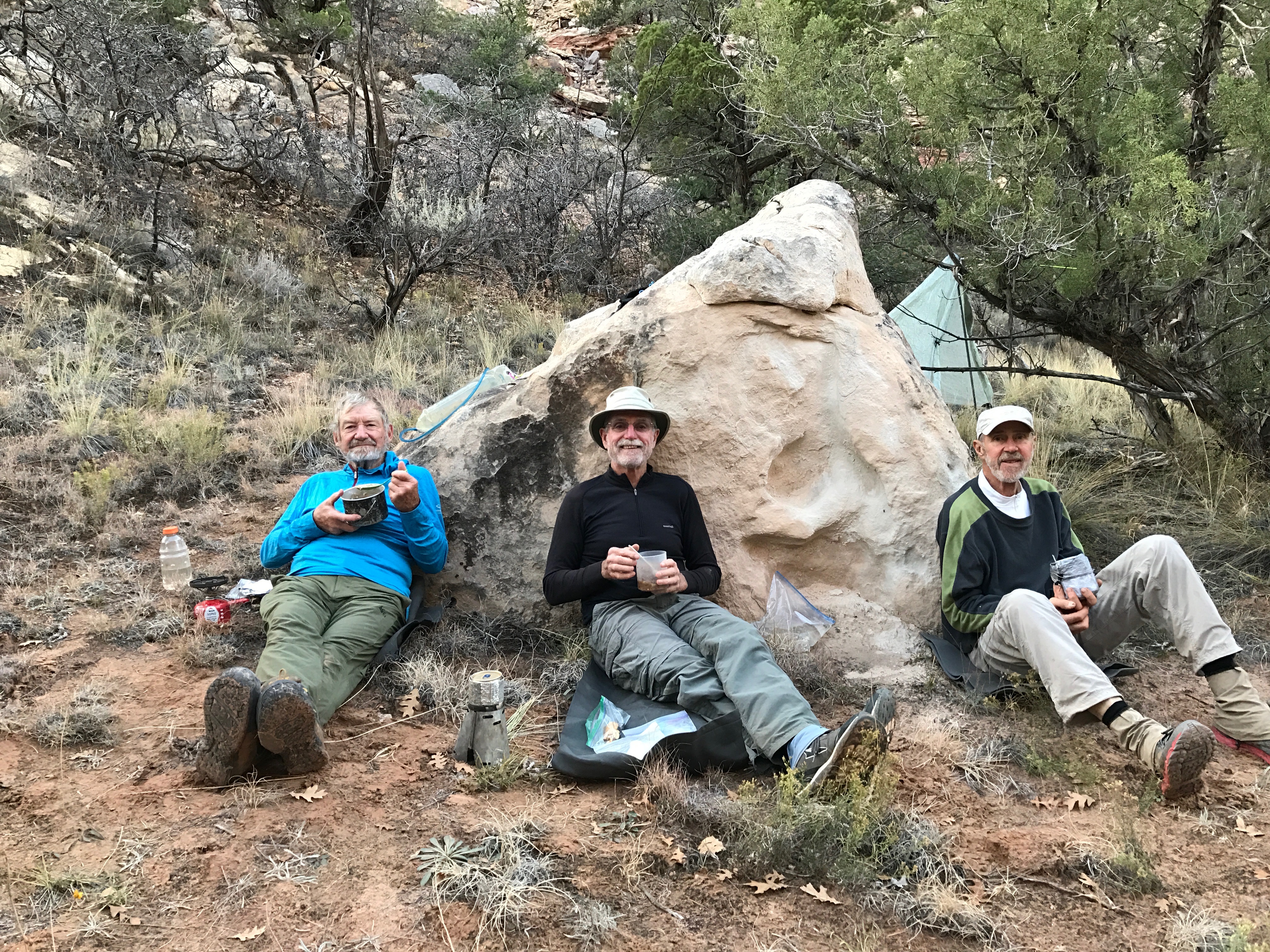
We spilt up when the river bank is larger than we can see thru the foliage, using coded yodels for communication and then gathering around when we find a living heirloom, each taking a series of recording chores. Melissa managed the most difficult, bushwhacking a direct route to the river to establish distance from the water. Mike and I counted stems (trunks out of the ground), girth and struggled with identifying species IMG_5771surrounding the tree. By mid-day many of the long slender plants started looking very much the same. Pictured is the list of common names we encountered and the code we needed for logging a tree’s vegetative environment. An interesting TED talk describes how plants communicate and share below the ground (worth viewing). We also needed to photograph the tree with ID number, which involved hiking back far enough thru the brush to find a suitable profile.

There are always interesting things to see besides legacy trees.  This river P1020020canyon was home to many in past centuries, just as all the other canyons and deserts of the Southwest.  In one alcove above an early twentieth century cowboy settlement, we stumbled upon an Indian settlement and granary with corn cobs and pottery shards.

A good time was had by all and we look forward to another section of the river next year.

To make sure I don’t bring the same Version 2pair of worn out hiking shoes I did the same gesture I used to do leaving a boat yard in the past. This dumpster was right next to the first ice cream stop out of the desert.


West Fork

tgCampDespite not being allowed to hike in the Canyonlands National Park on arrival, as planned (all reservations and capacity was filled), we opted for hiking in the Butler Wilderness Study Area just below Canyonlands.  Access was 60 miles further south and this area was part of our original exploration route anyway. This diversion knocked off a half day on each end of the five day trip, so we came out in four days.

NotchWater was the controlling factor on this desert hike so we had to carry five or six liters much of the time. (Five liters of water is more than my entire pack weighed before water.)  Fortunately we found an elk and wildlife watering hole up a side canyon the first day and that afforded us further exploration looking for routes over the canyon walls. This “notch” (pictured on left) was our first success in finding a way thru the cliffs.

5routesWe’d mapped out five potential routes and only managed to pass thru 2 of the 3 we tried. Hiking was often tough as we were on game trails and bushwhacking rather than frequently used routes.  The washes were dry and sandy except when they were overgrown with vegetation which forced us up onto benches.  It was very interesting to see these areas of seldom-travelled and little-known parts of the desert wilderness.

CampSome nights just finding a flat spot for three tents proved challenging as you might notice in the lead photo.

It’s only twice a year that you can go into this region since summer and winter prove inhospitable.  We won’t be able to go back now until the Fall for more exploration. This was a great warmup or shake-down for a season of ultra-light backpacking.

BearTracksWe were overwhelmed by the number of bear tracks we saw of the way out. We’d seen single tracks occasionally, guessing they were at least a week old, but these tracks were recent, like that morning. A whole family was just ahead of us by the looks of it. There must have been several yearlings along because they often scuffled in the sand as they lumbered along.  We used the defensive measure of talking loudly to them as we followed along, “Hello bears, we right behind you.  No need to turn around.”  The tracks winnowed down to a couple after several hours and finally down to one set. At the last fork before our ascent over the exit pass the last bear took the left fork to our relief while we turned right.  Even though we’d planned to end the day before climbing the pass, we decided to soldier on over to put some distance between us and that bear we’d herded up the canyon.

New UltraLight Pack

IMG_5526Does this pack make my butt look big?  It’s hard to check the fit of a new pack when you’re home alone. But there’s always a way in this new digital world.  (I’m sure to get comments on that location for carrying an iPhone as awkward and difficult to frame the snapshot on the trail.)

Our cadre of UL hikers are heading out for an exploratory trip into the southern region of Canyonlands. Will, the veteran explorer, has this region pretty well dialed in, but he is always looking for a new path thru the sandstone bluffs.  Topo map’s can’t give you a true answer whether a route down thru boulders or up a hillside is “doable”, but Google Earth 3D gives you a little more encouragement.

FiveFingerRocks

Canyonland routesAs you can see from the tracks superimposed on Google Earth in photo on the right, Will has covered and explored much of this region already. It’s a real pleasure to hike with him and benefit from his extensive knowledge of these areas.

The only downside to checking out these routes is that you have to carry a lot more water than normal.  Six liters is what we’re planning on for this section and that’s 13.23 pounds of water.  Which is 4 pounds more than my *Base Weight of 9 pounds.  Fortunately our 5 day food weight will be down some from the approach hike and that water weight will decrease each hour we’re on the trail.

Regarding the new pack in the top photo: It’s a zPacks Zero (weighs in at 13 oz with extra custom features) that I ordered last Fall and haven’t had an opportunity to test it out. It’s only 5 ounces less than my other UL pack but was time to upgrade and save the other one for heavier loads.

Acclimating back in Durango isn’t quite complete, although the important things like taxes, re-stocking the larder, and getting back to the gym routine have been accomplished. The transition from sea level to the Rockies takes 21 days for the hemoglobin to increase it’s oxygen carrying capacity and that’s only 2/3’s done.

A couple of river trips are next on the schedule after this 5 day adventure in the Utah desert, and by then the snow’s will be greatly receded and hiking in the high country will be possible. Come join us. I’ve got an extra UL pack now.

*BaseWeight – Total weight on your back without consumables (water, food and fuel)